
Steep, Remote, Inaccessible: How Drones Reach the Terrain Traditional Forestry Can't
There's a category of land across the UK that sits outside the reach of conventional forestry operations; not because it lacks value or potential, but because getting machinery to it safely and effectively is either prohibitively expensive or simply not possible. The steep hillsides of the Scottish Highlands, the deeply incised valley sides of Snowdonia, the remote fell ground of the Lake District and the escarpment woodlands of the South Downs all present versions of the same fundamental challenge. The land needs managing, but the tools to manage it conventionally can't get there. QuadRotor's woodland and forestry drone services operate precisely where that constraint is felt most acutely.
What Makes Certain Forestry Sites Inaccessible to Conventional Equipment?
The barriers are usually a combination of gradient, ground condition and remoteness rather than any single factor in isolation. A moderately steep slope on firm, dry ground might be manageable for a tracked vehicle. Add waterlogged soil, loose surface rock, or a gradient that exceeds safe operating limits for available machinery, and the same site becomes a genuinely different proposition.
UK upland forestry operates across some of the most topographically complex terrain in Europe. The Cairngorms, the Brecon Beacons, the North Pennines and the hill ground of mid-Wales and the Scottish borders all present combinations of steep gradients, exposed aspects, high rainfall and remote locations that make conventional machinery operations costly, slow and, in some cases, dangerous. The land management objectives (bracken control, woodland creation, species restocking after felling) don't disappear because the terrain is difficult; they simply become harder and more expensive to meet.
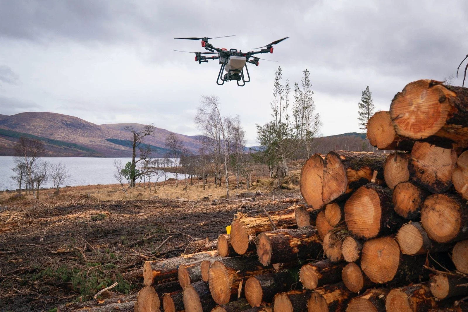
How Do Onboard Sensors Allow Drones to Operate on Difficult Terrain?
The XAG drone platform carries advanced sensor systems that continuously adjust throughout the flight, responding to changes in terrain gradient, wind speed and direction, and other environmental variables in real time. Rather than flying at a fixed altitude above sea level (which would result in inconsistent height above the target on sloping ground), the aircraft maintains a consistent distance from the surface beneath it, following the terrain's contours as it rises and falls.
For forestry applications on steep ground, this terrain-following capability enables consistent seed or product distribution across a hillside where gradients change significantly from one section to the next. The drone adapts continuously; the output to the ground below remains even regardless of what the slope is doing.
Does Remote Location Affect the Operational Feasibility of Drone Forestry Work?
Remoteness is a more manageable constraint for drone operations than it is for conventional machinery. A tractor, tracked vehicle or manual team working on a remote hillside needs access tracks, potentially significant site preparation and logistical support, which can significantly increase the cost and complexity of the operation. A drone operation requires a suitable take-off and landing point within a reasonable distance of the target area; in practice, that's a far lower bar to clear than the access requirements of ground-based equipment.
For sites in the Scottish Highlands, the Welsh uplands or the more remote sections of the English national parks (where access tracks either don't exist or couldn't support heavy machinery without significant damage to sensitive ground), drone deployment is often the only realistic operational option for the scale of intervention required.
What Types of Forestry Work Are Most Suited to Drone Operations on Difficult Ground?
Seeding and broadcasting are the most immediately applicable uses, distributing native woodland seed mixes, grass and wildflower seed for habitat restoration, or fertiliser granules across terrain where even distribution would be impossible to achieve by any other means at a comparable scale. Spraying applications (bracken control, invasive species management and targeted weed control around establishing tree seedlings) are equally well suited to difficult terrain. The same terrain-following capability that maintains consistent seeding height also maintains consistent spray coverage across a sloping, uneven target area.
Across the upland forestry regions of the UK (where national woodland expansion targets are driving significant new planting programmes on ground previously considered too difficult for cost-effective management), these are precisely the applications most in demand.
How Does Drone Operation on Steep Ground Compare to Helicopter-Based Forestry Work?
Helicopter operations have historically been the aerial option for truly inaccessible forestry sites - used for seed broadcasting, fertiliser application, and other large-scale treatments on ground beyond the reach of machinery. Agricultural drones offer a different set of operational characteristics: lower operational cost per hectare on appropriately sized sites, greater precision in distribution, and the ability to work at lower altitudes with more controlled output than a helicopter application typically achieves.
For the scale of sites that characterise much of the targeted woodland creation and bracken control work currently being undertaken across the UK uplands (sites that are large enough to make manual treatment impractical but not necessarily at a scale where helicopter operations become economically straightforward), drone application occupies a genuinely useful operational middle ground.
Is There a Maximum Gradient That Drone Forestry Operations Can Work On?
The drone itself isn't restricted by ground gradient the way wheeled or tracked machinery is; it operates above the surface regardless of the angle the surface presents. The practical considerations relate more to wind exposure on open upland sites (where gradient and aspect create more challenging flight conditions), the distance from the take-off point to the furthest extent of the treatment area, and the site's specific characteristics in terms of obstacles and restricted airspace.
A site assessment is always the starting point for any forestry drone operation on particularly challenging terrain; it's the stage at which the operational plan is developed, flight parameters are established and the most effective approach to covering the target area is worked through in detail. For land managers considering drone operations on genuinely difficult ground for the first time, that assessment stage is where the feasibility picture becomes clear.